What can Trimble RealWorks do?
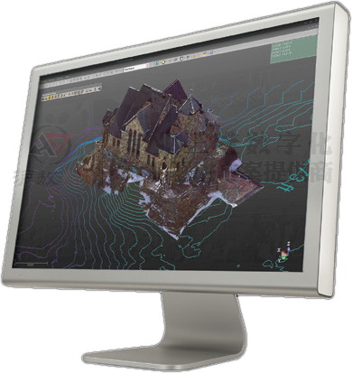
Trimble® RealWorks® software can register, visualize, measure and process the scene point cloud data collected by Trimble's 3D scanning and measuring instruments. Trimble RealWorks is advanced in technology, but simple to operate, and can perform the following functions:
Manage, process and analyze massive data sets
Efficiently manage massive data sets through partial loading technology
Realize smart measurement-a series of data such as horizontal distance, slope distance, vertical distance, clearance, diameter, angle, azimuth, slope, inclination and coordinates can be easily measured with a few clicks of the mouse
Easily extract targets from scanned data
Show results by generating roaming videos and Google Earth KML models
Provide point cloud automatic registration function
Quickly check target quality
Generate point cloud registration report
Combine data from Trimble GNSS, optical instruments and 3D scanners effectively
Easily export selected content to various CAD design platforms
Publish independent project data packages for offline viewing, browsing, measuring and marking annotations
Trimble RealWorks not only has the powerful ability to easily handle massive amounts of data, it is also particularly easy to operate. The software uses guided operations, allowing you to complete complex data management and processing step by step, ensuring that you can always achieve your goals and your customers' goals.
Supported workflow
Trimble RealWorks supports a wide range of workflows. You can edit, process and calibrate the data collected by Trimble 3D laser scanners efficiently and reliably.
Data entry and basic management
Perform standard data management tasks, input and output those important and mainstream data formats.
And Trimble RealWorks provides a set of powerful standard tools for data visualization and output to a common CAD platform.
Data registration / 3D point cloud
Trimble RealWorks has a large number of registration tools to facilitate customers to quickly register engineering and analysis results.
Automatic target extraction and registration: automatic detection and extraction of spherical targets or black and white planar targets, and then automatic registration.
Use target analysis tools to quickly analyze, extract and edit targets.
2D and 3D results
Produce a variety of intermediate or final results.
There are a large number of 2D and 3D tools in Trimble RealWorks, which can generate:
Section view
Triangular Model
contour line
volume
Line drawing
Orthophoto
model
Advanced registration
Set the scanning method freely.
The advanced registration tools in Trimble RealWorks are easy to use and ensure that the registration results are accurate:
The non-target registration function allows you to scan without placing any targets, and it is done automatically.
Refined registration allows the best project registration accuracy to be obtained through the point cloud of each individual scanning station.
Advanced 3D inspection and generation results
Compare the as-built data with the original design, avoid post-processing, etc.
The advanced detection capabilities of Trimble RealWorks are ideal tools for monitoring applications such as civil engineering (roads, tunnels and bridges) and mine monitoring. The results can provide users with richer, detailed and useful information:
Check the as-built data and compare it with the actual design.
Generate and visualize inspection results to detect any changes.
The obtained two-dimensional and three-dimensional visualization results of differences and deformations make deformation analysis easier.
Input cross-section diagrams and geometric design primitives from CAD design files dxf, dwg, and export graphics files in dxf, dwg or dgn format.
Use RealWorks integrated printing interface to directly print the results to realize information sharing.
Application (vertical industry application)
Storage tank capacity calibration application.
Accurately calculate the volume of vertical cylindrical storage tanks and output corresponding tables based on metrology industry standards.
3D CAD model production
Create 3D models for rendering, calculation, and other finite element use.
The Trimble RealWorks modeling module can generate partial or complete models very quickly, and is especially suitable for applications where the built geometry can improve or completely affect the intermediate and final products.
Trimble RealWorks can use basic solid geometric models to create a variety of models to express the complex as-built environment.
Data modeling makes the transmission of data to analysis software faster.
Reality-based 3D models are the most effective way of simulation.
Collaborate and share
The publisher can easily share data with customers in a customizable professional format.
Use the publisher to publish items and display them in a web browser. The released project can be displayed in 2.5D, and can be measured and marked and annotated. Publishing can also include images, videos, multimedia, and links to files and web pages at the same time. When creating a published project, you can determine whether to allow data extraction from the project by selecting Allow or Disable.


